


How to map your racetrack with Google Maps
A clear and accessible map of the racetrack or event track…
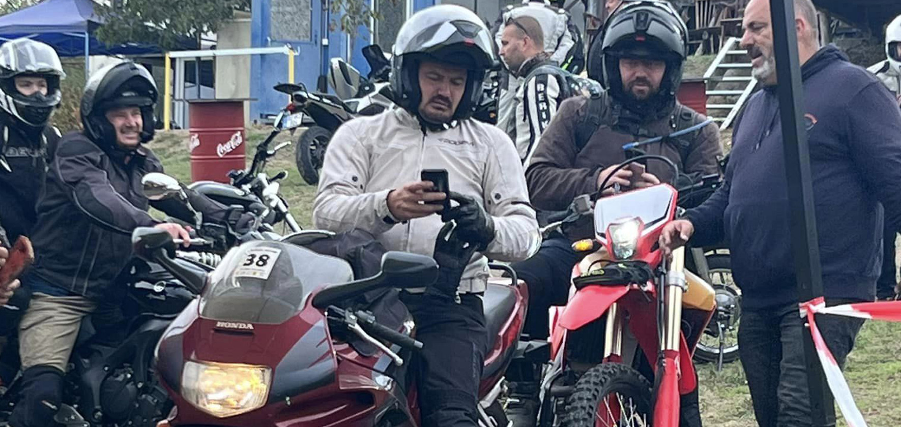
PILOT SYSTEM is an innovation specifically designed to support outdoor competitions and challenges. From a single-person challenge to complex competitions for thousands of people
The second generation of this innovation is specifically aimed at competition organizers,
and team competition coordinators to offer a one-of-a-kind and exhilarating experience during outdoor events and competitions.
This revolutionary app takes events and competitions to the next level by improving the experience, and heightening the thrill for participants.
The system records all route data, times, locations, positions, and speed, and manages definable NO-GO zones, sends a message to the users through the system and offers many other functions. With accurate data, events can remain transparent, clean, law-abiding and safe.
With PILOT System, we make your event original and transparent!
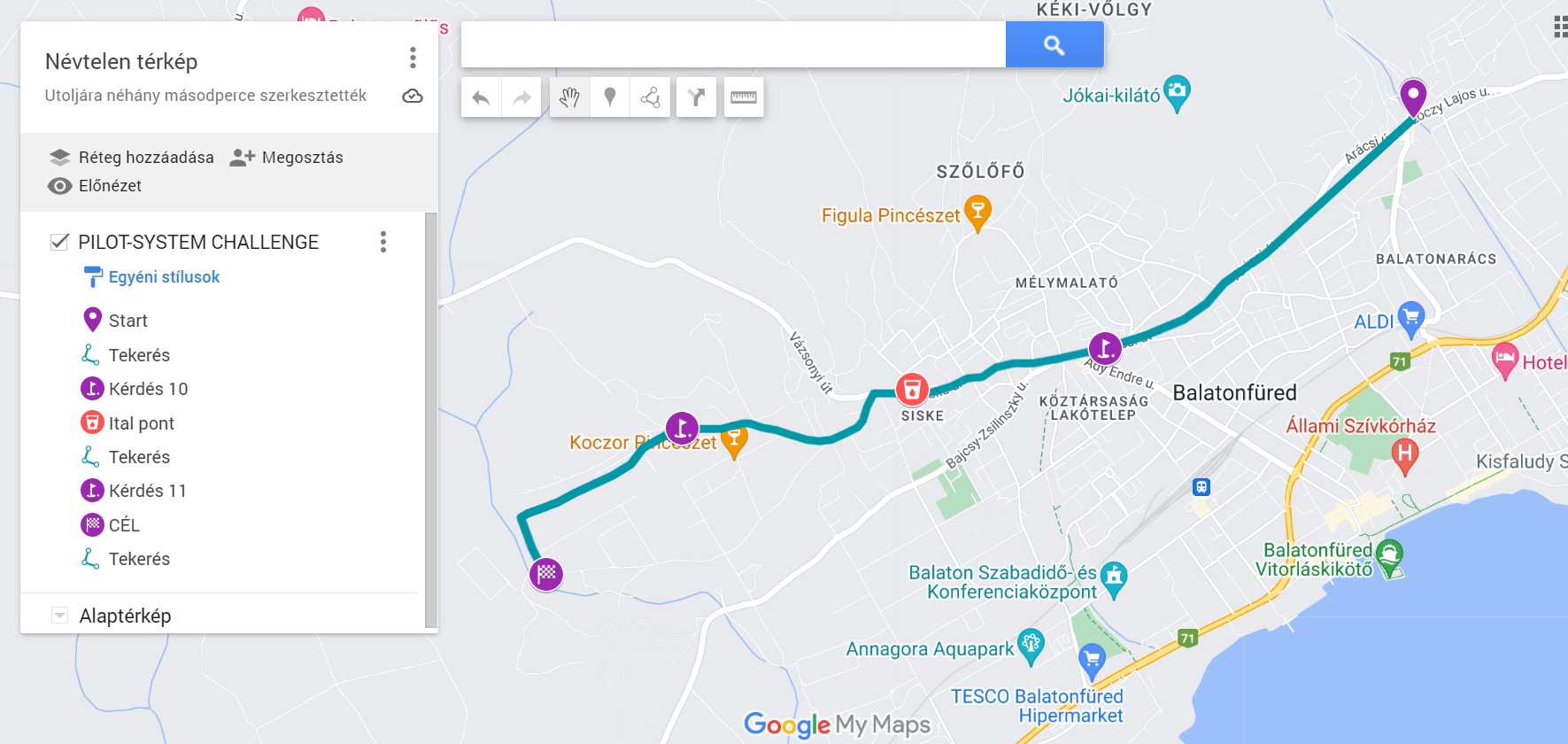
A clear and accessible map of the racetrack or event track…

We were delighted to deploy our troops in Venice, Italy, for…
If you are a competition and/or event organizer, please contact us under the contact menu.
Don’t miss out! Download the PILOT SYSTEM app now, and make your next competition unforgettable!


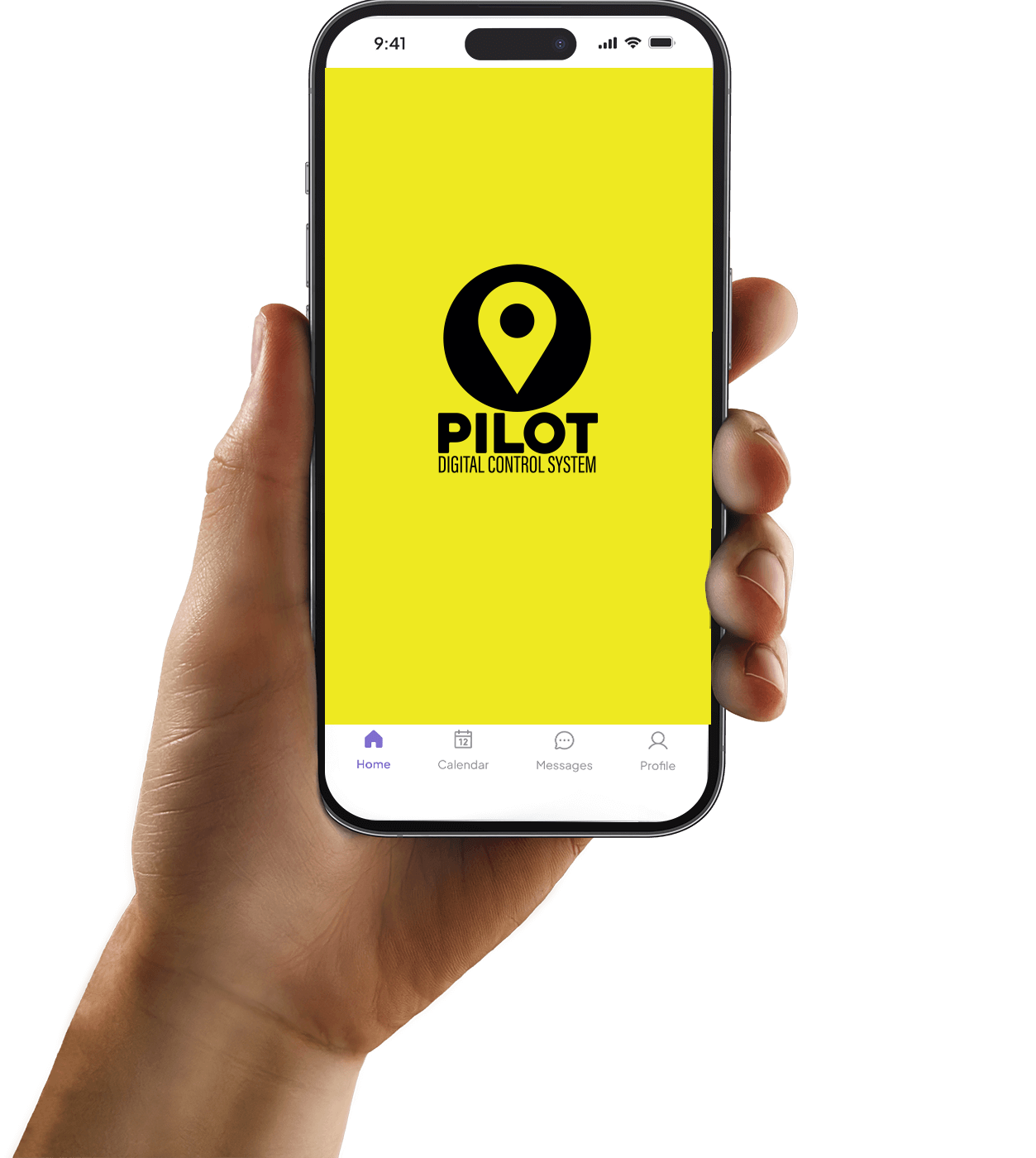
Our app is available in Play Store/Apple Store under the name of PILOT SYSTEM
You have to sign-up before you can start using PILOT SYSTEM. This step helps us identify you, link your input data to you, and organize your information.
The app downloads a lot of data and stores them on your phone during use. It manages and stores maps, zone and target data, GPS values, etc. When offline, these data must be temporarily stored in the device and then synchronized to PILOT SYSTEM after the internet connection is restored. This is an automatic process 😊 and requires no action on your part.
The app transfers the collected data and the content required for operation (coordinates, photos, tasks, videos, etc.) via internet traffic. An internet connection is no longer required after the start of use, but it is highly recommended for a fuller experience and more accurate location tracking.
The essential function of the PILOT SYSTEM application is to define, record, store and display positions. It performs continuous interactions between the users and the admin interface. The admin interface evaluates and displays the received data based on a specified complex algorithm. In order to be able to identify the dedicated organized points, and link them to a specific user, it is necessary to identify the user. With the user account created in the PILOT SYSTEM application, you will be able to use the verification system, as well as sign up for and participate in competitions and challenges. Based on your data, the competition organizers will be able to identify, display, and score you in PILOT SYSTEM. When filling the registration form, there are required fields and optional fields to enhance user experience.
You have to sign up before using the PILOT SYSTEM. This process is essential. This step helps us identify you, link your input data to you, and organize your information. You only need to register in the app once, after which you are free to use it for multiple events.
Once registered with PILOT SYSTEM, you have a PS (PILOT SYSTEM) account. In order to participate in specific events, you only need to use your registered email address and the password you provided during registration to log in.
• n the case of a unique-code event, a 6-digit identifier must be entered after clicking the select race button. This code is communicated by the organizers. Participation in a competition like this is only possible with the identifier.
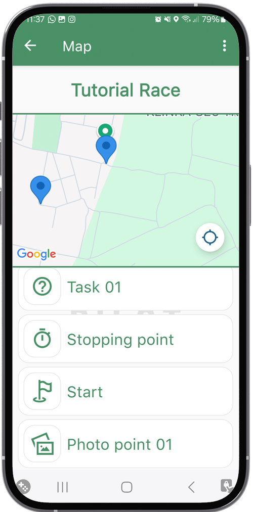
After entering the code, you will reach the event page. At the top, the time of the competition is displayed, which counts down from starting at the start point until reaching the finish line.
As soon as you pass the "Start" coordinate and complete the points in order, the application automatically updates the list with the relevant items under the "completed points" menu item.
• For webshop purchases, after the purchase, the selected event will be sent to your device, where you can find it in the list of events after logging in to your PILOT SYSTEM account. You do not need a 6-digit code for this event type. In this case, you can participate in the event within a time frame determined by the organizers, and you can start participating by passing the starting coordinates.
After logging in the app, by going to Events, you can check out the list of available events. In the menu, all competitions and events where your application has been accepted are available, either after purchasing them in the online store or by participating in a competition type that requests a 6-digit code.
• The website of the competition publicly displays (i.e. also for visitors without a user account) the following data of each competing pilot: Name of pilot, nickname, website, photo, car photo, and the content of the MY PROFILE interface, except password. These data will be displayed when the registration for the given event has been finalized.
• Furthermore, the organizers of the specific event can see the following data required for the organization of the competition: name, nationality, email address, mobile phone contact, billing address, car registration number, nickname, and the content provided in the PR and marketing fields, as well as any data that the applicant authorized the organizers at the time of registration to access.
For the duration of a specific event, the public can see on the map of the subpage of said event, for the duration of the given event, all the starting positions of those who: have signed up for the event, their registration is final, and pressed the "Start" button to indicate that they will participate in the competition or event on the given day. These positions can be displayed in real time or with a pre-set delay (e.g. 10 minutes) selected by the event organizer. On the online map, visitors without a user account can only see the delayed status, but the organizers and/or "official users", i.e. authority representatives can always view the actual position (after logging in).
During the specific event, photos taken for PILOT SYSTEM to solve a given task are not public, they are only available on the internal server. During an official investigation, these photos may be released to the relevant authority, otherwise they will not be made public without the permission of the related team.
During an event, the application is primarily an information sharing and communication channel between the participants and the organizers. The application collects the data necessary for executing the competition tasks, and transfers the required data to the evaluation system. The evaluation system developed for organizers is an automatic scoring system that operates continuously in the background, and is controlled by the control person appointed by the event organizer.
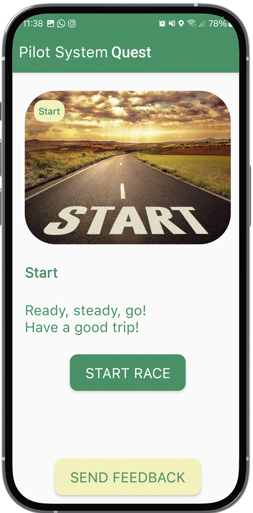
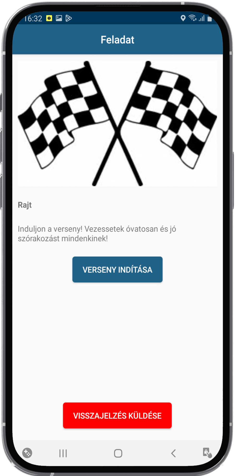
The starting process may differ from one event to another as determined by the organizers. The event begins when passing the "Start" coordinates. In order to participate in the event, it is necessary to approach the starting point (or one of the several starting points, if applicable). Arriving within the range of the starting point coordinates, the “START” button appears on the device. By pressing this button, you can indicate that you wish to start the event. By pressing this button, the time limit countdown starts, and the event begins. The event ends when passing the finish line (or one of the multiple finish line coordinates, if applicable), and the countdown stops.
• If the finish line coordinates are passed, the event is completed. It is very important to only approach the finish line if you want to finish the event. After passing through this point, it is not possible to continue the event, the event will be closed, and depending on the organizers, the data collected so far will be evaluated.
• Organizers can assign multiple finish line coordinates for a specific event. In this case, when a user passes through any published finish line point, the specific event is finished for them.
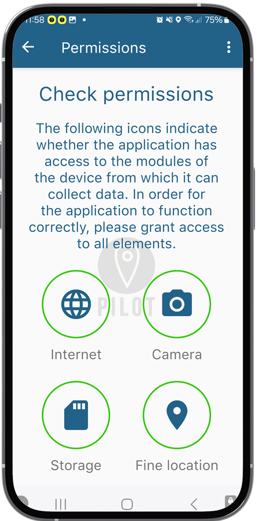
• Check the permissions for the app to make sure you have given all the required access.
• The accuracy of devices may vary. Move your device around to make sure it can detect the specific position.
PILOT SYSTEM has indicated that your speed is higher than the limit set by the organizers. Confirm the message and drive slower.
No. The data collected so far will be stored. Please start your device as soon as possible and continue your event. In the event that the location tracking function is disabled on a device, the admin system will send an immediate notification to the organizers, who may disqualify the team.
Yes, but we definitely do not recommend it. During an event, you will receive all information through the system. Updates and protocols of the respective phone manufacturers may differ from one device to another. It is important to ensure that data are continuously synchronized.
Yes. A simplified navigation interface shows the recording of your trail, as well as the task points designated by the organizers. Depending on the event type, you may see a track on the map to help you complete your route. By clicking on each task point on the interface, you can start the navigation towards that point. (When a task appears, it does not necessarily mean the exact reaching of that point. This may depend on the specified range of the task.)
For complex competitions, when the goal is to navigate and achieve the task points individually, we recommend that you use a separate tool for navigation.
A so-called activation radius is assigned to each task point. This radius can vary from 10 to 5,000 meters per task point. When a task appears, you may not find the solution right there where you are. Navigate to the exact allocated point of the task, and try to solve the problem there.